Legacy Roads
Legacy Roads are roads that the Engineering Division of the Deschutes County Road department have entered into digital databases with spatial references. The information for this database was gathered from the Commissioners Journals from Deschutes and Crook counties and other sources. These roads were entered using Coordinate Geometry gathered from the Commissioners Journals and Historical Survey information. This information was compiled to be used as a starting point for road research.
The information gathered from the Commissioner's Journals was done one page at a time. Each book was searched to gather as much information as possible concerning roads created within the county. Deschutes County was formed December 13, 1916. Before that time, the whole area was part of Crook County. Information was also gathered from the Crook County journals.
Converting the information to the computer was done one road course at a time. The roads were input using coordinate geometry. Coordinate Geometry uses Distance and Bearing information in a textual format to create graphic lines and curves to represent the location. This location is also tied into specific known locations such as section corner information created by the PLSS.
The software used to create this was Arc/Info software by ESRI. Using their COGO package to take advantage of coordinate geometry.
After the creation of the data, it was uploaded to ArcMap software, also created by ESRI, the maps were created and then exported to a .pdf format with Adobe software.
COUNTY DISCLAIMER
This Page is intended as a guideline and should not be mistaken for law. For clarification of specific locations, consult the Deschutes County Road Department, or a licensed public land surveyor. For legal issues concerning the above, please consult your attorney to find out your legal options.
The county is not responsible or liable for any information printed on this page or the files contained within.
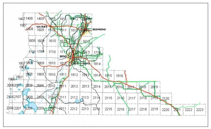
Click a section on the map below.

